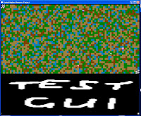
Just a quick update today! well the pathfinding is still in its conceptual stage, everything is set up ready for its implementation with the agents being controlled by keyboard input still. But when they move the map changes with their position as was seen in the screenshots earlier. I have also thought of a great way to record the results of this project and display them in a an easy artistic way.
I will store the number of moves it takes for each agent to complete traversing the terrain. This data will then hopefully be written to a separate text file for each agent and then be used to formulate a graph detailing which agent (if any) and thus which behaviour type has been most successful over time. Another feature that could be useful for research is the idea of having the application run at different speeds with the option to have it autoplay. What I mean by this is to be able to run the application so it runs much at the pace of a modern game would, so the user can switch views and see how each agent progresses. Another option could be to have the program run at its maximum possible speed and to automatically reset and re-run each time the final agent reaches its destination.
This of course would be useless from a viewers perspective, but it could potentially give rise to a vast amount of test data very quickly, if the application was left running say over night. Anyways these are just some of my quick thoughts on ways of completing this project and possible conclusions to meet for the upcomming presentation /panic again :D


